
Blog
Day 84 (26): I See A Light
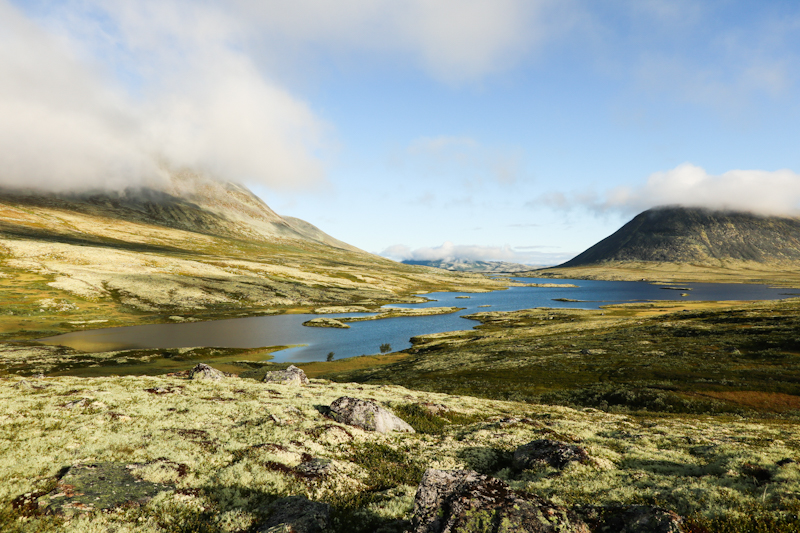
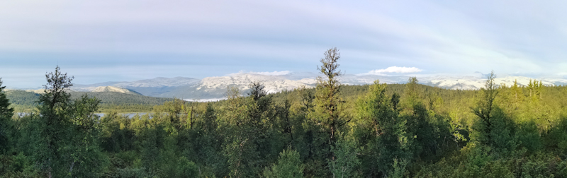
Rom to Lindesnes Fyr
Distance: 33km
A walk in the park. At least I thought so when I set sail at around 9. What a late start. I feel splendid as I navigate through Lyngdal then along windy, narrow and surprisingly busy roads.
It's then, when I somehow hit a wall. Going suddenly gets tougher. Some friendly locals, enjoying the sun on their veranda, invite me for a late breakfast at 11:30. A lovely gesture and a well needed boost.
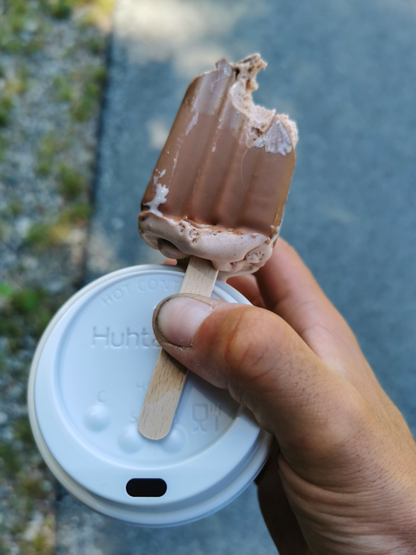
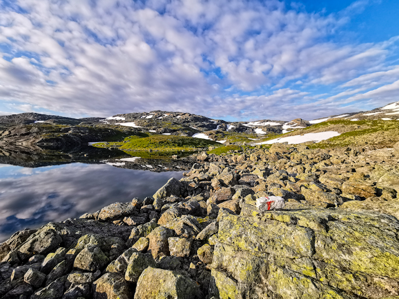
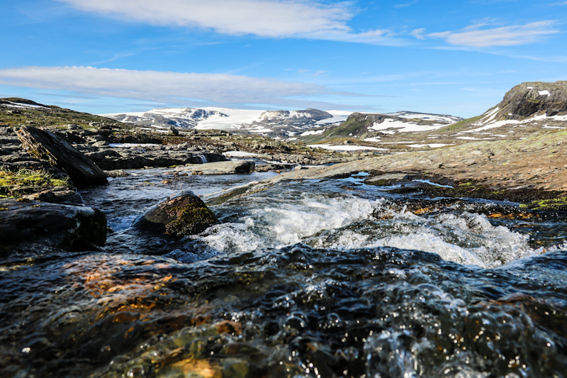
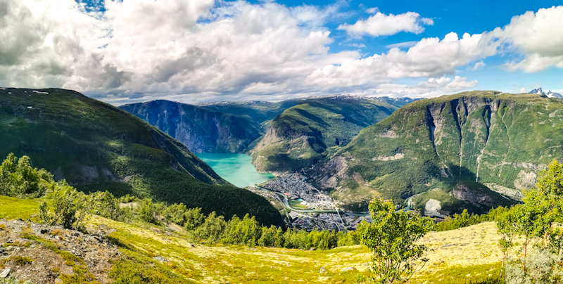
Mid afternoon I reach Spangereid. One last ice cream stop and a visit to the cemetery to fill up my water bottle. Since it's quite late already, I will stay near the light house and want to make sure I have enough water.
The last 10 kilometers! Not too emotional. Only when I spot the lighthouse through a gap in the rocks my heart pumps a bit faster. I made it, well nearly.
Since the lighthouse and the area surrounding it are a museum, one has to pay to enter when it's open. It's not a lot, yet somehow feels wrong.
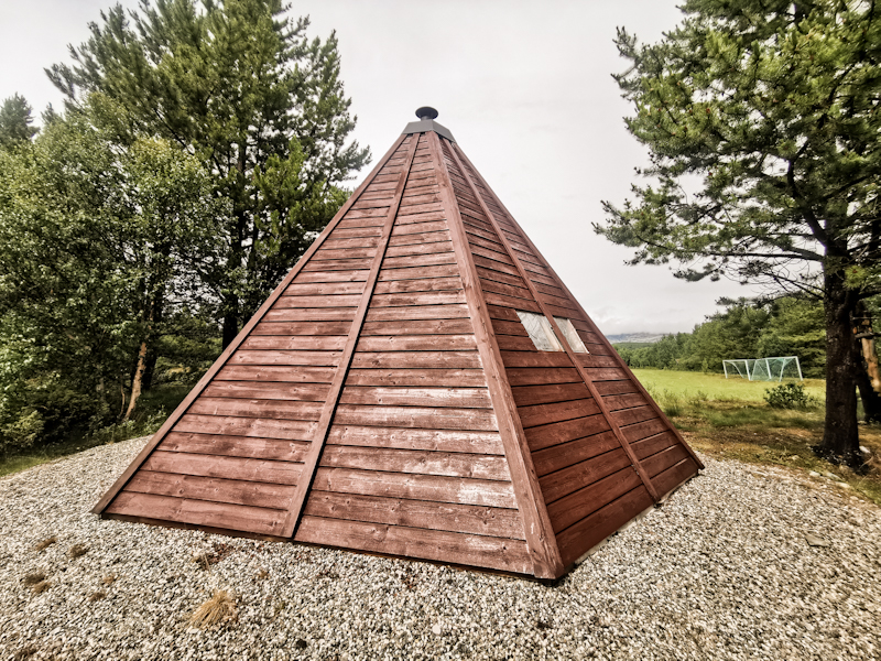
So I climb a nearby hill, cook my dinner (celebratory Mac'n'cheese), while watching over to the light house. Such a pretty view.
By 20:00 I make my way over to the Fyr, the lighthouse. Initially built in 1656, making it Norwegian's first one.
Finally there! Norge-på-langs officially completed!
It's an wonderful, interesting place with lots of history and things to check out. Eventually, the sun is setting. A surprisingly spectacular sunset and a magical end to my journey.
I put my sleeping right next to the lighthouse. A sheltered spot with amazing views. Can't get any better.
A Swiss family is hanging around as well,celebrating our Swiss National Day, singing the anthem. Feels like being home.
Eventually, they leave, I fall asleep quickly. Only wake up once. The fyr's light beam is spectacular under a wonderful sky full of stars.
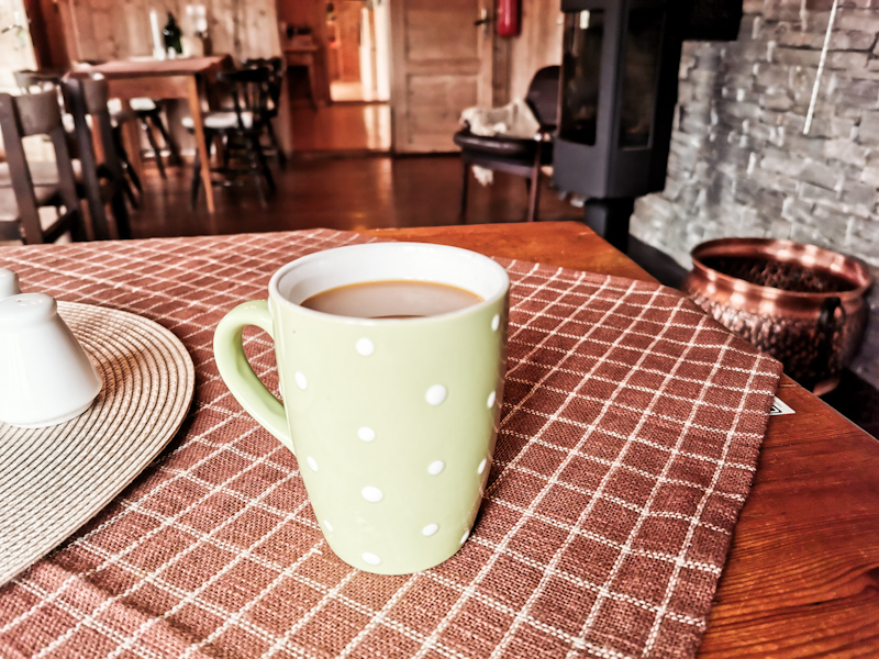
Back to sleep. A deep sleep and I even sleep through sunrise and wake up to a steel blue sky. Some more photos and while I am typing these lines, my coffee is brewing next to me.
I take it slowly. I won't get a ride out of here, Norway's southernmost point, anytime soon anyway.
And where to? Well north,obviously. And then... I will see.


Day 83 (25): When Trail Magic Hits
Gletnesvatnet to Rom
Distance: 38km
After a wonderfully calm night with a good sleep and a black tea, I walk my first couple of steps on a stunningly beautiful morning.
It's all road. Initially quite back roads but mainly a, at time, busy main road. I remain on this road, following a river, for over thirty kilometers. Easy navigation.
I stop at a nice waterfall for lunch, at a road side shop for ice cream and coffee to go. Walking goes smooth and I am well on track to reach my goal for today, Lyngdal, in the late afternoon.
Until... Until I start talking to two cyclists on the road. Long story short, one thing leads to another, and I get invited to one of the cyclist's house. His daughter is celebrating here 22nd birthday and the whole family is attending.
A wonderful evening. Delicious and a shear amount of food, a very interesting and intimate insight into a Norway's family live, a hot shower, my washing done, a real bed,...
I could go on and on but it go late yesterday. 2 in the morning actually and I am still in bed the following morning as I am typing this. Still a bit tired after a short night but incredibly happy and thankful.
Shortly, I will head down to meet some of the family for breakfast. Energy, for my last day on the trail. I know, after last evenings great memories, it will be a wonderful day.
Lindesnes, here I come!


Day 82 (24): Looking Ahead
Åseral to Gletnesvatnet
Distance: 30km
A long night with little sleep. The locals kept on talking until early in the morning. Not loud but still making sleeping difficult. At least they keep the fire going throughout the night so I have a nice warning fire to wake up to.
Since I have got tons of food, I cook myself a porridge before climbing down the steep hill back to the town, where I hit the road.
These road walks give me time to think, to plan. I still have a month in Norway. What am I going to do with my time? So many options. I can't find the right one. There's no rush though. And tomorrow's another day.
After a bad night's sleep, going is generally tougher than normal. So I instantly and spontaneously decide to call it a day onxe I walk past a fishing shelter. It's huge, it's perfect to stay for the night. Great views and plenty of driftwood for a nice little fire.
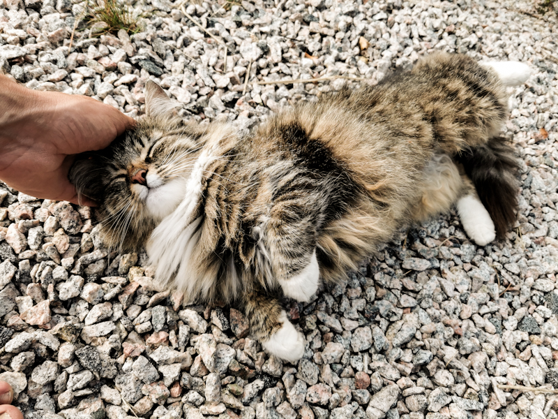
For most of the evening, I have company of a cat. It's very friendly but terribly hungry. I feel a bit sorry that all I can offer are some bland, boring oatmeals, which isn't even exactly healthy.
Time passes by quickly. After a swim and warming up by the fire, I slip into my sleeping bag,keeping my fingers crossed for a good night's sleep.


Day 81 (23): ha det bra, mountains!
Stemtjonn to Aseral (Tippin Hut)
Distance: 38km
After a pleasantly warm and surprisingly calm night, I take my sweet time packing and leaving - enjoying my last couple of minutes in the mountains.
And sure enough, after just a couple of hundred meters, I descend steeply down into the valley. A quick ending of my walk in the mountains. Ha det bra, mountains. Bye bye mountains!
After a muddy walk through bush and forest, sooner than expected, I join a freshly bulldozed road. From this moment onwards, it will be roads only, all the way to Lindesnes. Roundabout 130 kilometers.
I follow Langvatnet, a dammed lake. Water level is low, revealing what's generally beneath the water surface. A petty sight.
I pass a skiing village and after more than 30 kilometers reach Åseral. A small town, but most importantly, it has a supermarket. Time for resupply and a little treat. Somehow, the time is flying. By the time I finished resupplying, it's nearly 6. There's a so called day hut right up the hill. That's where I am headed.
It's well worth the climb. A stylish hut. Not made for sleeping but just to hang out. With USB chargers, a nice fire place and nice views. Some locals are spending the night up there as well. We have a wonderful time around the fire, sharing stories and food.
It's warm with no rain expected. I decide to simply roll out my pad, hoping to do a bit of stargazing tonight.


Day 80 (22): To Cross Or Not To Cross
Aklaevatnet to Stemtjonn
Distance: 35km
Another crisp cold morning. Unlike yesterday, I decide to stay in my tent until the sun pops up from behind the mountains. That should be around 06:00. Or so at least I thought. Murphy's clouds places itself right where the sun would rise. I wait, I wait a bit longer, another 10 minutes. Screw it.
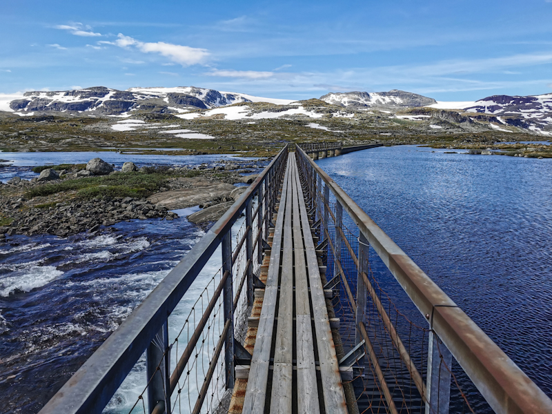
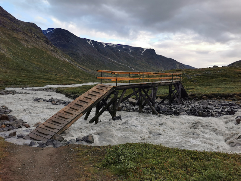
Without sun and warmth, I pack and leave. Sheep tracks take me down a couple of kilometers to a road. There, I have to make a decision: follow the road a bit and then turn right to Haheller hut (which is a 2 kilometers detour) or continue along the lake then cross a bridge? Problem: the bridge is only depicted in one of the two maps I use for navigation.
Since there's a sign pointing along the lake for the bridge option, I risk it, hoping there would be a bridge.
The bridge is massiv, I see it from far away. Lucky! Not really. As I get closer, I notice a piece of the bridge collapsed.
Three options: turn back and go the long way, follow the lake then hope that I eventually rejoin via an off-trail routing or just cross it.
Being on a thru-hike, I don't like option one. Option two is also kind of a long shot. So it's option three. Carefully, I climb down the collapsed part, balancing over some remaining metal pieces. It requires concentration but is actually not as risky as I thought. Still, I think if I wasn't on a thru-hike I probably wouldn't have done it. However, on long hikes like this one, generally I am willing to just go for it in such instances.
With the obstacle crossed, the remaining part is boggy with lots of ups and downs. Not slow going, nevertheless it's tiring.
Eventually, it's time to find a place to pitch for the night.
Not easy because of the wind, wetlands and vegetation. After a bit of struggling, I find a reasonable spot. I guess after the last fantastic campspots I got a bit spoiled. This one is a bit mediocre in comparison but quite nice nonetheless.
It's my last time on Norge på langs out in the "wild". Only 5 more kilometers and I will hit a road. From that moment on it's road walk all the way to Lindesnes. Around 150 kilometers I think. While I won't miss all the mud, I sure will miss these camping spots.


Day 79 (21): Fascination Camping
Ulvtuvtjonn to Aklaevatnet
Distance: 34km
After a cold night follows a cold start. Instead of taking the correct path after leaving the causeway, I follow an old marker, guiding me in the complete wrong direction. Still a bit sleepy, it takes me a minute to realize.
Back on track, progress is good. My foot feels better and also the trail is nice to walk on. For mosts parts at least. It's muddy once I briefly descend below the bush line. Nothing unusual and expected.
There's really not much worth mentioning. Just a nice day walking.
As I get closer to my campspot, big, black clouds are rolling in over the hills. I feel some drops of rain and kind of expecting the rain to intensive.
By this time, I feel exhausted. There's no way I can go any faster. Slow but steady I make my way south.
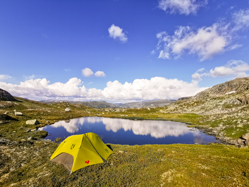
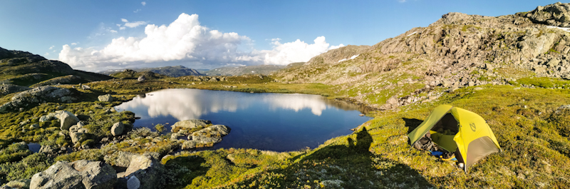
I pitch my tent at the first best place. Just as I am inside it starts pouring. My campspot is not optimal at all. Uneven, rocky. Once the rain stops, I quickly move to another spot. Nestled between rocks, a river and the lake, the views are outstanding. Once more. Somehow, I have the feeling that my campspots are getting better and better!


Day 78 (20): life's a bi... beach
Vassdalstjorn to Ulvtuvtjonn
Distance: 23km
20 days on the trail! Time is flying!
Well, not this morning at least. The storm intensified overnight and is still raging outside when I wake up. No hurry to get going.
I drink one cup of coffee after the other, start reading a book that is laying around, plan my next stages. A lazy morning.
My left foot needs some attention as well. An open wound seems to have gotten infected. The smell is quite bad. With my nearly non-existent knowledge, I clean it with some sanitizer I find, dry it, put some of my antiseptic solution on it. Looking much better now. Hopefully, it will get better.
After some more coffee and some more pages of the not so capturing book, the sun is coming out and I decide to leave.
Leaving the hut behind, I continue skirting around Blasjo, a massive dammed lake, which I have been following since yesterday noon. It's okay going initially until I get hit by a heavy, around 2 hours lasting rain shower with strong winds. The rocks become wet and slippery. I am keeping my head down, just functioning. Surprisingly, I'm not angry or frustrated.
Eventually, the rain stops. I have gotten uncomfortably cold so it's a delight, when the sun finds it's way through the clouds.
Time for a break. It's where I suddenly feel exhausted. The last 2 hours have been tiring. Since I have phone signal, I decide updating my blog, just distract myself a bit.
After doing so, I continue on a trail, which is hard to walk, up and down, partly badly marked. Difficult.
Then, out of nowhere, there's this beach. Small and maybe not the most spectacular one. But it's so random. Such a welcome surprise. Up here in the Norwegian mountains.
I can't resist, go for a swim in the clear water. It gives my mood a needed boost.
However, I don't walk to far anymore. As I cross two lakes via a natural causeway, I decide to call it a day. The wound on my foot hurts, and anyway, it's kind of a magical place. Surrounded by water, out there on this small strip of land.
A short day. Late start, early finish. But a tough day. Very challenging hiking. Many times did I have to use my hands climbing over rocks, many times I was close from slipping on the wet rocks. While not that many kilometers, it still feels like I have achieved something today.


Day 77 (19): The Saving Hut
Moltenuten to Vassdalstjorn
Distance: 39km
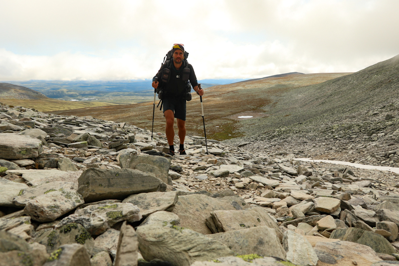
Fog is engulfing my campspot as I pack. It lifts quickly though and just as I start my walk, the sun briefly breaks through the fog. Since I descend into the next valley, I dive back into the fog shortly after. It's okay going. Not as bad as yesterday, yet, it's pretty slow going at times. This changes, once I pass Jonstollen Hut. A beautiful trail takes me up Kyrkjesteinskaret. I fly up there. Knowing that I want to do a 40 kilometer day somehow makes walking easier. The motivation is simply better than, when, let's say, I plan a 25 kilometer day. Probably something psychological behind it.
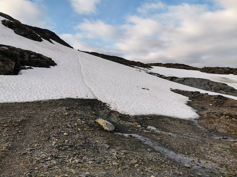
Anyway, the last bit up the pass is tough. Nearly half a kilometer up a snow field. Hard work!
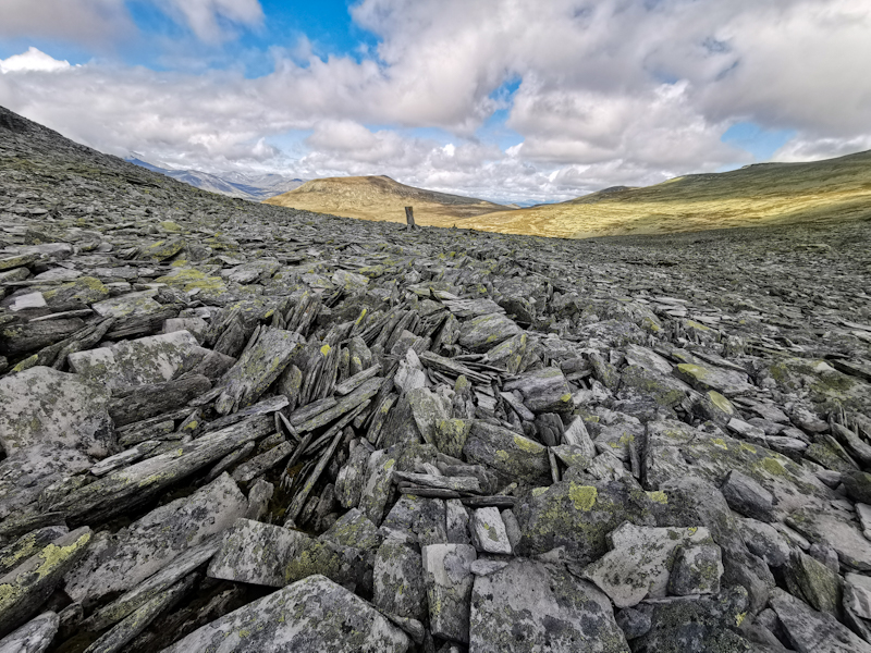
Once on top, the topography changes drastically. Hard to describe but the area consists of huge, shallow rocks. They are grippy, nice to walk on. A continuous up and down. Sometimes pretty steep and technically challenging. But still quite enjoyable.
Even a bit more enjoyable as I am currently far away from civilization. A very remote area. No roads, no phone signal, no people.
Around lunchtime, a bad weather front is approaching surprisingly quickly straight from the south. Initially, it's only clouds and winds increasing, then there's the rain. First rain after around 7 sunny days.
It's too rocky and too windy. However, lucky me, there's a hut just around my 40 kilometers mark. While I was avoiding them for the last couple of weeks, today I go for it. As fast as I can.
Not that easy. With the rain, the rocks feel slippier. Wise to slow down.
But eventually make it there. A lovely hut. Expensive, yes, but the amenities and the views are well worth it. And... So far I am the only one! What a luxury.
Outside, the brisk wind has turned into a small storm. No way I could have pitched the tent.
The huts have solar power to charge phones and a gas stove to cook food. I make use of it both and slowly but surly settle in for a comfortable night in my bed.
I have no idea what the weather will do. My weather forecast is 2 days old. In other words useless. But as just written. Let me worry about tomorrow. For the moment all I am looking forward to is a good night's sleep.


Day 76 (18): A Tough One
Haukeliseter to Moltenuten
Distance: 5+30km
A black Range Rover pulls over to give me a ride back to Haukeliseter.
Normally, these cars never stop, but I got lucky after waiting for 5 minutes at the bus stop (yes there would have been a bus at 1:05am, wtf?...).
Anyway, the ride is once more spectacular and shortly after 19:00 I get dropped off where I started my resupply adventure 7 hours earlier. With still enough daylight, I continue my walk for 5 kilometers, passing dozens of tents and campervans, all getting ready for the night. Eventually, I leave the road and on a rough, undulating trail, leavinh the people behind. After an hour of walking, I have enough, pitch my tent and go straight to sleep.
Since it has gotten late, yesterday, I take it slow, waiting for the sun to rise before hitting the trail. A trail, which keeps being a bit slow going, and, as I climb the first saddle extremely rocky with big, sharp rocks, which require quite an effort to be conquered. Luckily, going gets faster on the other side. I pass several lakes, the views fantastic. And so is the weather. Perfect for a quick lunch break swim.
At one point, I descend over big, flat rocks below the scrub line, where the trail becomes a muddy mess. My mood drops. I have gotten so used to the rocks, the mountains, the open, that being back in the scrubs feels a bit depressing.
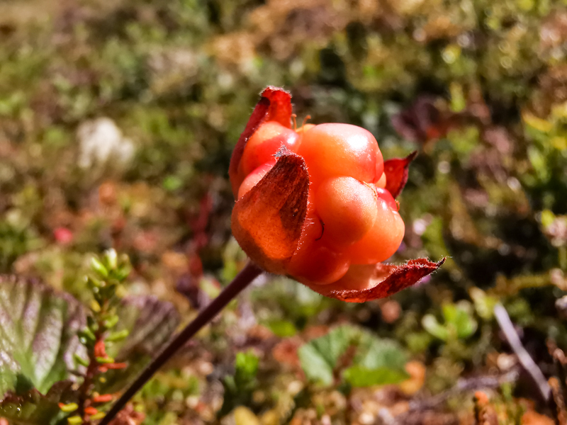
After a long chat with a lady at one of huts, my mood is improving and gets even better, when I spot some blue- and cloudberries. The trail then climbs steeply out of the bush, back into open. It's where I decide I have hiked enough for today. 30 kilometers. A heavy backpack and challenging trails made it a hard day nonetheless.
So I am more than happy to find a lovely spot, overlooking a valley to the north, with impressive views of big, towering cumulus clouds over the Finse area. Seems like they get a lot of rain, while here, the sun keeps on shining.


Day 75 (17): A taste of civilization
Buadalen to Haukelisetter
Distance: 25km
With the grocery store calling, getting up and hitting the trail goes relatively easy despite the cold temperatures.
While the beginning is a bit rough going, the middle part of today's hike is wonderful. Nice trails, even better views. In fact one of the best views I have had in while. Maybe especially because I was expecting a rather dull walk. Despite the food calling, I take it slow, taking in the views, going for a quick swim.
Right in time, actually. The trail is getting busier shortly afterwards. A lot of day trippers. Doesn't really matter. The nice views are gone anway and so are the nice trails. So I sped up as much as I can and descend the last 5 or so kilometers to Haukelisetter, restaurant, hotel, a tourist hotspot. Crazy busy. Yet, getting a hitch out of there is not that easy. Cars either full or old people ignoring me.
After 45 minutes a red car (my lucky car color) stops and the lovely woman "just heading to where the sun is shining" is taking me to the next town. The drive is spectacular and a joy per se.
In town I first start looking for a power outlet. Getting my priorities straight. Food can wait. I get lucky near the sports ground, where I have my peace and quiet and plenty of space to lay out my stuff, update my blog etc etc.
Shopping is generally a breeze. In and out. A small but well stocked grocery store.
Packing is more time consuming. However, getting rid of packaging, saving weight and space, is worth the energy.
I'm still in Roldal as I write this, just finished a phone call with Fredy. All in the green back home.
Soon my phone is fully charged and I will try to hitch a ride back to Haukeliseter. If it works, sweet, if not, I will try my luck tomorrow. Anyway, it will get late. So I post today's blog already and will give an update on how things have worked out tomorrow.


Day 74 (16): Short term planning
Ovre Bessevatnet to Buadalen
Distance: 30km
My rain measuring tool, aka my cooking pot, says roundabout 17mm of rain overnight. Less than expected but still enough.
The wind last night made my tent rock and roll. However, it hold up just fine. Just the rain fly leaking kept me initially busy. With my pack's raincover and my rain jacket, I was able to (surprisingly) keep most of the water out of my inner tent.
I wasn't expecting to sleep a lot, but was still able to sleep every now and then.
The rain stops at around 6. Earlier than expected. Still, since already planned a lay in, I stay in my sleeping bag, squashing mosquitoes waiting for me between inner and outer tent. It's rather addictive, oddly satisfying.
The mosquitoes get their revenge once I crawl out of my tent, pack and leave.
The weather is a mix of sun and clouds, the trail a bit of everything. Rocky, muddy, snow, rivers. After my long day yesterday, going is a bit hard. My feet hurt a little, making every step an effort.
To distract myself, I am thinking of tomorrow, when I will cross a highway. Since I skipped my last resupply, it's high time for me to hitch into town to stock up on food. I'm pondering which direction I should hitch, whether I should stay in town for the night ect, ect.
What I came up with is: hitching west to Roldal, food for 6 days and not staying in Roldal. Somehow, I have to charge my batteries though. I will figure that one out when in town.
This short term planning is something I like doing. Keeps my mind busy. Not just with shopping but also the route, where to camp and so on.
Speaking of camping: after 30 kilometers I am done walking for the day. One steep, final climb takes me on a pass. The views spectacular. So that's it. My spot to camp. After yesterday's focus on a sheltered place, today, I am looking forward to enjoying the views.


Day 73 (15): flat out windy
Drageidfjorden to Ovra Bessevatnet
Distance: 48km
A mostly cloudless night. Without my tent's raincover, I had a lovely view at the night sky and at a nearly endless dusk and dawn.
It's a warm, humid night, my sleeping bag wet from the morning dew.
As I pack, the sun just rises from behind the hills. A great view and a great start into my day.
A long day, as it will turn out. After climbing over a first hill, terrain quite abruptly gets much flatter, less rocky but boggier. An interesting change. The scenery reminds me of the one in Finnmark, far up north.
The mosquitoes are crazy in the beginning and I already start worrying about them, following me all day. However, a brisk southerly wind comes up, blowing them away. With the wind getting stronger, blowing right in my face, also going is getting harder. I make good progress though. Even though, here and there are still rocky, slow going parts. To be honest, I don't enjoy the scenery that much. Maybe it has also to do with the high clouds, which make everything look a bit dull. Eventually, I enter Hardangervidda National Park. The scenery doesn't change much. Just more people.
With the wind still blowing strong, I decide I would continue to cross the flat, to find some more sheltered places to pitch my tent, meaning a long day.
Despite feeling reasonably fit, like yesterday, I eventually start feeling every muscle.
Since the winds are supposed to increse even more and torrential rain forecasted for tonight, I want to find a reasonably sheltered spot. Not an easy task. It takes me a while until I find something suitable. Not perfect but I hope it will do. Too tired to look any further. And the sky looks like rain in imminent.
Right after finishing my dinner, the rain starts. I retreat into my tent, preparing myself for a very wet, windy night,crossing my fingers that my not-so-well-in-shape-anymore tent will keep me dry and safe tonight.


Day 72 (14): On Top
Geiteryggvatnet to Drageidfjorden
Distance: 40km
Today, while hiking, it crossed my mind that, gosh, I have been repeating myself in this blog over the last couple of days. Rocky trails, reasonably good weather, scenic campspots and generally good hiking spirit.
So I tried to come up with something different today, the sun however, relentlessly shining on my head, with no shade whatsoever, rendered my brain useless.
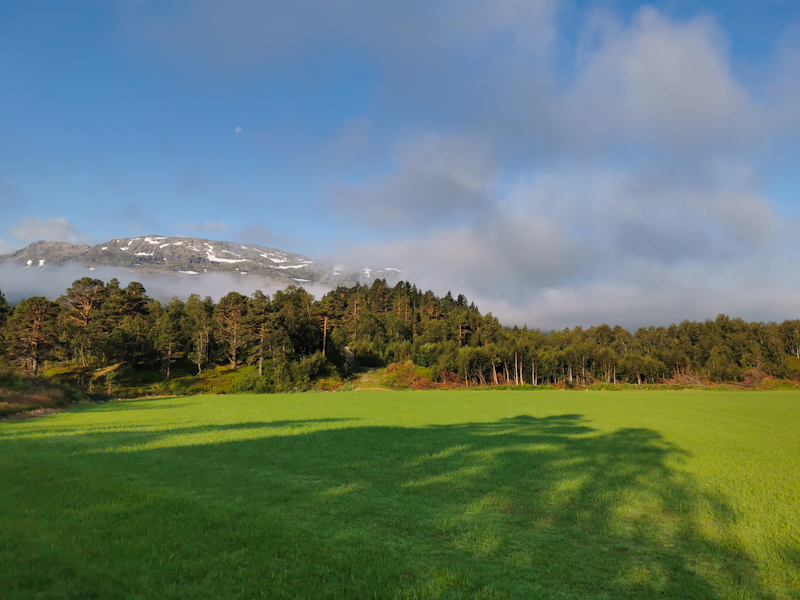
Therefore, I am sorry, I write for the 10th time: Rocky trails, generally easier going and amazing views of the Finse Massif with its glaciers. Finse is also the name of a train station. With 1222 meters the highest in Norway but for me mainly a place to quickly recharge my batteries.
The area around the train station is a zoo. Just too many people out and about. As I hit the trail again, it's getting a bit better. Yet, there are many people hiking it. I feel great, overtaking roundabout a dozen people. It's the time of the day, everything works smoothly. I'm in the flow, the mood fantastic. My motivation top.
But what goes up eventually must come down. I hit the wall after 32 kilometers. Suddenly, going is harder.
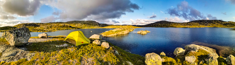
Therefore, I am released when I spot yet another wonderful place to pitch my tent. Overlooking two lakes.
It's only 17:00. But that's more than okay. After 40 kilometers, I am just happy to enjoy the view.
And by the way: Halfway! Distance wise at least. Roundabout 500 kilometers hiked with 500 more to go. I'd love to celebrate it with some extra chocolate but since I spontaneously decided to skip my next resupply tomorrow, it's conserving food for me. Don't worry though, I will definitely catch up on the missed chocolate during my next resupply!


Day 71 (13): Rock'n'Roll
Valefatnet to Geiteryggvatnet
Distance: 38km
Being waken up by the rising sun, shining on my tent, warming it up, happens rarely, almost never actually. For that, I generally leave too early.
Today is the exception though. The fantastic location of my spot gets hit by the first rays of the raising sun at shortly past 5. An amazing feeling, making my campspot even better and a worthy candidate for my top ten all time favorite campspots.
I'm on a mission though and thus have to eventually leave my spot. While the trail continues to be rocky, weather and views are spectacular. Progress is slow, not just because of the rocky terrain but also because of the numerous photo stops.
As I descend, going gets easier. I feel great, lots of energy. I am flying up the next pass. A beautiful, fast trail. Shortly before the top, catch up to a young Norwegian hiker. We start a conversation, walking together for quite a while, following lakes across a rocky landscape. It's not often that I meet people hiking at the same pace. So that's a nice change. After a while, I stop for a break, going for a swim in one of the ice cold lakes, doing laundry, using the sun to wear dry my clothes.
It's rough hiking over rocks again. Very hard on my feet and knees. A couple of kilometers later, I meet my Norwegian hiking companion again. He has some pain in his feet, slowing him down. I match his pace and together we continue nearly all the way to Geiterygghytta, where he is staying and I pitch my tent nearby. Not as spectacular as last night's spot but a nice view of the lake nevertheless.
Honestly, it felt good, having someone to hike with, today. Especially, across this challenging terrain.
Overall, a very good the on the trail. The hiking spirit is up high. Exactly as it should be!


Day 70 (12): Lost And Found
Suleskaret to Valevatnet
Distance: 35km
Rarely have I ever spent such a rainy night in the tent. The constant noise prevented me from falling asleep. Headphones and some relaxing music did the trick.
When I woke up during the night, only light rain remained. Nevertheless, the inside of my tent was something in between damp and wet.
A couple of hours later I pack. My campspot is engulfed by fog. Inside temperature in my tent: 6°C. Uncomfortable.
Way finding in the fog is challenging. There's no formed track and I navigate from marker to marker, carefully hopping from one slippery rock to the next.
It's a constant switching from looking ahead to find the next marker to looking down at my feet.
One could think I am a bit annoyed but, no, I have to concentrate so hard, there's no room for emotions.
Eventually, I am descending below the cloud base, out of the fog. The clouds, however, remain. Unlike forecasted, they don't dissipate. So I make my way south, the trail is getting easier to walk on, therefore, progress is good. Until shortly before Bjordalsbu, where the trail is getting rocky again. And it's staying rocky. While never steep, it's a technical hike, requiring a lot of concentration. It's a constant reading of the rocks, carefully finding a suitable rock to place my foot on. Nevertheless, every now and then a trip or a rock under my foot moves. Especially, towards the end, when I am mentally and physically getting tired. I have been lucky, some bruised toes and a small cut on my shin. Nothing to worry about but it shows, how fast something can happen.
During these last few kilometers, the weather improves dramatically. The colors change, the views into the distance are suddenly here. It feels great to finally have some sun again.
I have a lake in mind, where I would pitch my tent. 2 kilometers before, however, there's the perfect place to pitch a tent (and looking at some pegs lying around, was probably not the only one thinking it).
It's a bit windy. Perfect to dry my tent, sleeping bag and everything else that needs to be dried.
Tomorrow, well, the weather is supposed to be good again and looking ahead, the trail rocky again. But for the moment, I just enjoy the moment, the views.


Day 69 (11): Average
Sletterust to Suleskaret
Distance: 23km
Finally a good night's sleep. How I missed it! Maybe because I knew today would be a short day.
So I take my sweet time, eating some chocolate while still burried deep in my sleeping bag.
By eight, I am on my way. The trail is neither good, nor bad. Some fast parts, some slow parts. Average. Some muddy parts, some rocky parts, some smooth, gravelly bits. Average. Also the the weather is very average today. Better than expected, yet a bit grim looking. No rain, hardly any sun. And finally the landscape. Nice, mountainous but not breathtaking. Average again.
Below average is just my pace. I go for a looong coffee break, then have a looong chat with two fellow countrymen, which I meet shortly afterwards. Just the couple of kilometers before Sulebu, I activate my afterburner, flying towards the hut, only to be slowed down again later on by rocks. Back to my avarage day.
Anyway, just after passing these rockfields and the Suleskaret Pass, I spot a nice place to camp. Only 16:00, just a bit more than 20 kilometers hiked. Definitely below average. Anyway, the view is spectacular and I decide to call it a day.
Just as I have finished pitching my tent, it starts to rain. Luck. Definitely above average.
I'm happy having done a short day. My body needed it. Tomorrow and day after tomorrow, the weather is looking very promising. Hard to believe at the moment but if it really is sunny, it's going to be fabulous day in the mountains.


Day 68 (10): Tusenmeteren
Fleskedalen to Sletterust
Distance: 45km
Another night of bad sleep. Might be partly the new sleeping pad, which I still have to get used to but I think the main reason is the rain and with it the noise.
After my long day, everything takes a bit longer this morning. Eventually, I am on my way, descending from 1000 meters to sea level. The track is steep in parts, but generally not too difficult. Highlight of the morning: Vettisfossen. With 275 meters free drop, the highest in Norway. The view, its force, the noise. It's breathtaking. I take a quick break, eat some chocolate to savor the moment a bit more.
Eventually, I continue my descent down to the fjord. Still steep, still not too challenging. At the bottom, it's a 3 hours walk to Ovre Ardal, where I resupply, charge my batteries and plan the next section. All in all, it takes me 2 hours before I am on my way again.
And while in the morning it was 1000 meters down, it's now 1000 meters up along an old coach road. Apparently it took more than 30 years to build but eventually was replaced by a new road.
Climbing with a backpack full of food is strenuous but eventually I make it. Just as I am arriving, the weather improves. Feels good to have the weather on my side for once. Especially, because the views of the fjord are wonderful. I keep following the old road, getting soaked by yet more rain. Camping spots are rare so I keep on walking, eventually leaving the road. As I climb further into the mountains, I find a neat spot, overlooking the valley. I use a dry spell to pitch my tent.
Just as I have finished settling in, the rain sets in again.
Another long day. My body feels tired. In combination with the bad weather forecast, I'll probably take it a bit slower tomorrow, making a shorter day.
Now let's hope for a good night sleep for a change.


Day 67 (9): Approaching The Limit
Spiterstulen to Fleskedalen
Distance: 40km
I know I repeat myself but it's another rainy night. Heavy rain. Putting my backpack raincover on top of my leaky rainfly as additional layer helps me from getting even wetter.
I wake up around 4 but remain in my sleeping bag since it's still raining. Despite a long day ahead of me. At 5 it stops and in no time I am ready to hit the trail. After a short while, I meet Monika in front of her tent, cooking a porridge. She's is flip flopping Norge pa langs. At the moment, she's heading south, but taking a different route than me. Since she carries food for up to 3 weeks (!), no need to resupply. I must admit, I'm impressed.
It's time to move on, rain starts again. Several river crossing make the hike challenging. Fording these high flowing rivers requires care and since it's ice cold glacial melting water, it's pretty uncomfortable as well.
Luckily, the rain stops, make my life instantly more pleasant. It even gets better, when I head straight for a rainbow, popping up in front of me. Like yesterday, my hike takes me over a mountain pass. Again rocky, again slow going. For most of the time, I follow a hiker. With the approximately same pace, I follow him a couple of meters behind until I eventually close up. A bit of chit chatting and when Leirvassbu, a massive hut complex, is finally in front of us, we go in, have two well needed cups of coffee each.
It's raining again outside and our motivation to head out there is not really there. So we chat some more until I really have to leave. The late start, the slow trail and now the long break. I'm far behind my schedule for today. It would become a long day...
Thanks to an unexpected gravel road, the next 5 kilometers are surprisingly easy going. Also afterwards, descending to Skogdalsboen, progress keeps being good. Shortly after the hut, I spontaneously decide to jump into a river. Taking my smelly clothes with me into the water. It feels great thanks to sky, which cleared up. I put back on my wet clothes to dry wear them.
The trail gets rougher again. Progress on these last kilometers is painfully slow. I feel tired, ever step requires plenty of effort.
It's the view that keeps me going. As I get closer to the fjords, the valley narrows, huge waterfalls everywhere. A spectacular view.
Yet, the views only help so much. During a last steep descent to some flatter grounds, I feel every muscles in my legs. And when I struggle to find a campspot, my mood drops completely.
Anyway, now, after pasta and porridge, laying on my new sleeping pad, my world feels in order again. Yes, it was a long day. Too long maybe. I sure came close to my limits. Maybe not something I need every day, but every now and then I think it's a good thing to check where they are.


Day 66 (8): Rock Overload
Randsverk to Spiterstulen
Distance: 40km
I wake up to a spectacular morning sky. What a treat to start my day. My morning mood gets even better, when I notice my tent is completely dry. For the first time on this trip.
After a couple of kilometers, clouds are pushing in from the north, getting thicker with every minute. In Glitterheimen, at the end of an never-ending gravel road that I walked yesterday and this morning, I plan to grab a coffee. The hut is busy however, the line at the reception long. So I pass and shortly after leave the warm hut.
Back on the trail, going gets harder. As I climb Velsglupen, with 1650 meters one of the highest points on this trip, the trail gets rocky. Very rocky. Going is slow and with my not-so-fresh-anymore sandals, I feel every one of these rocks.
When the wind and the rain set in, I initially feel a bit down, but recover surprisingly quickly. I think to myself, I mastered much worse tracks and weather conditions on Nordkalottleden back in 2020. So this is actually a piece of cake.
And around 5 hours after leaving Glitterheimen without my coffee, I arrive in Spiterstulen. Another massive hut complex. Incredibly busy as well. Despite the adverse weather conditions. Should I stay or should I continue? Just booking a bed is tempting but somehow I feel like camping tonight. No idea why. Generally, I prefer a bed over a tent, especially when it rains.
So I continue. Back out into the rain, which is getting heavier. A bit more than a kilometer from the hut I have enough, pitch my tent in the pouring rain. Despite being incredibly quick, the inside is still getting wet. Still, I don't mind too much. Mainly, I am just happy to be out of the rain, after a surprisingly challenging day out in the mountains.


Day 65 (7): The Mountains Are Calling
Bekken to Randsverk
Distance: 45km
It has gotten late yesterday. Planning, organizing, packing. Some 'social' duties as well. When I finally called it a day, I immediately fell asleep. So a veeeeery good first impression of the new mattress. However, I must have been extremely tired and eventually woke up, feeling rather stiff. The pad is definitely firmer. But I think I will get used to it rather quickly.
Because of the late bedtime, it's not such an early start. Well, compared to other days. By 5 I am on my way. A humid morning, slightly foggy in the morning. As I climb out of the valley, it gets pleasantly warm. With 1000 vertical meters, it's a long climb, initially along gravel roads but eventually off track. Finding my own way. A bit trickier than I anticipated but once above the treeline, going is easier. I take the direct route up. My puls over 170 beats per minute. Unusually high for me while hiking. Anyway I feel good, the views are fantastic. Hundreds of flies follow me all the way across the mountain. As soon as descend below the treeline on the other side they are suddenly gone.
What follows is a long, tough roadwalk. Mostly across dairy country. Plenty of traffic, mostly Volvos, who are headed for a Volvo meeting. I pass the time looking at some of these cars and with plenty of ice cream. 3 to be precise. I wasn't expecting so many shops along the way. But I don't complain.
Despite all the ice cream, my legs start feeling tired, my back stiff. Once above the treeline again, I pitch my tent. No need to go any further. The views are spectacular. You can't imagine how happy I am that the weather is playing along. Enjoying it, as long as it lasts. Tomorrow, looks very differently.
It's when, I'll head into Jotunheimen National Park. Even deeper into the mountains. Exciting times ahead!


Day 64 (6): Roller-coaster Of Emotions
Straumbu to Bekken
Distance: 35km
No thunder, no steong winds. But another rainy night (at times it rained so heavily, the water penetrated the rain fly, making it an uncomfortable night), another early start, another fast packing due to mosquitoes.
The walk across Rondane National Park offers some wonderful views, however, due to a rocky track, my focus was mostly where I would put my feet down next.
On the other side of the park, at Rondvassbu, I more or less bump into Frank as he just gets out of the hut. Frank, a lovely hiker from Germany, who I met in Abisko, 4 years ago. Me on E1 southbound, he on his way to Nordkapp. Such a huge coincidence, we meet again. Again, I head south, he's heading north. There's so much catching up to do. We spend nearly 2 hours talking. It feels good and really motivates me to carry on my adventure.
After a long hug, it's time to continue. A long road walk to Otta to resupply. Or at least so I thought.
In Bekken, around a kilometer out of Otta, I get into a conversation with a local. And shortly after, get invited to pitch my tent in their garden. A wonderful, highly appreciated gesture as I don't have anywhere to stay in Otta.
I settle in, preparing for a relaxed afternoon. Well, at least so I thought again...
As I blow air into my mattress, three loud 'pops' make me flinch. It takes me a couple of seconds to realize that some of the seams of my mattress gave up the ghost. And from reports from other hikers I met over the years, that's it. Nothing to fix. Distaster. Yeah Maria, I know you warned me a while ago... But ignorant me wouldn't listen...
What to do? I take out my phone, google for sport stores in Otta. Bingo! But they close in less than hour. Marit, my trail angel, offers me her bicycle. What an nice gesture. A 10 minutes cycle takes me into town and to the sports store. Very limited selection. I go with one of their overpriced foam mattresses. Something completely different to my air mattresses. I'll report tomorrow how I slept.
Anyway, once back, I get treated with a delicious fish dinner with potatoes and carrots. We have very interesting conversations about the area. Great so get some background information about the area I walk through. Time flies. They are headed to some friends, I do my resupply, have a hot shower, write my blog. It's well past nine, whenn I finally retreat into my tent.
What a day it was. Full of surprises. Negative but (luckily) mostly postive ones. A day to remember for sure.


Day 63 (5): And Into The Mountains I Go
Dollbekksaetran to Straumbu
Distance: 40km
14 hours of rain. Not heavy but continuous. Everything in my tent is damp. Not a pleasant feeling.
So I start packing by 03:00. The super aggressive mosquitoes, going straight after my legs, are a good motivation to pack quickly. So soon after getting up I am on my way.
The rain has stopped, just some low hanging clouds remain. A friendly day weatherwise. Also the the rest of today's hike is wonderful from A to Z. Good but challenging, sometimes rocky trails, spectacular views and my body feeling fresh. A day like this is the perfect medicine too boost the hiking spirit.
Laying in my tent, overlooking a small alpine tarn, I feel satisfied after a rewarding day. Not even the strong winds and the towering cumulus clouds, which might even end up in thunder, can worry me at the moment.
I don't want to add anything else at this point. Rather, I'd like to let the photos speak.


Day 62 (4): Like A Racing Horse In A Cage
Brønnåtjønna to Dollbekksaetran
Distance: 30km
03:00. Even for me, this is an early start. However, with daylight permitting and bad weather forecasted for the afternoon, it's not the most stupid thing to set off that early.
It's cold and due to the overnight rain, the humidity high. Yet, it's a smooth start into the day. Until I climb out of Tylldalen towards Avdal. Overgrown track, wet, hard to follow. Several times, I loose the faint trail. It seems like a typical "connection trail" that somehow remained on the map but neglected by whoever is responsible for the maintenance. Anyway, eventually I make it to Avdal. I have walked for 4 hours, still, it's only 08:00. And my body is already ready for lunch...
After stuffing the bought food into my pack and getting rid of all the packaging, I continue, only to realize that I forgot my hiking poles in the store. Luckily, I haven't left the parking lot yet, so the detour is not that painful.
With my poles, I now definitely continue. After a short while, I spot 2 through hikers coming the opposite way! (we all look the same, it's not such a challenge to identify a through hiker).
A quick chat reveals that they are headed northbound from Lindesnes to Nordkapp and have been on the trail for 2 months.
As we can already smell the rain, we each continue our own ways. It felt good meeting them, knowing that I am not the only one out there.
Rain starts a couple of minutes later. Not heavy but continuous. Before climbing above the tree line, I decide to call it a day. It only 14:00 and I would easily be ready for another two hours. Physically. But walk another 10 kilometers in the rain, with no sheltered spots to camp... Not the smartest idea.
A bit of shame that the weather is holding me back. Stopping, beside the urge to continue doesn't feel right. In the beginning at least it did.
Now, I actually feel quite comfortable. A lovely spot under a tree, listening to the rain and plenty of time to write the blog.


Day 61 (3): the long way back into the thru-hiking mindset
Hodalen to Brønnåtjønna
Distance: 45km
Thanks to the firewood, the tipi is warm and cozy when I slip into my sleeping bag. Nevertheless, the sleep still isn't as deep as I hope it would be.
Maybe, it's, beside the not so dark nights, the usual tension at the beginning of a new hike, that is keeping me awake.
Anyway, it's an early start. By 04:30, I am on my way, climbing out of Hodalen on a particularly wet track. Yet, progress is smooth and once above the bush line, the views are beautiful.
Every now and then, there's even some sunshine, which really helps to boost ny hiking spirit.
Eventually, I join a gravel road, taking me down to Bydalen, before gently climbing up the other side of the valley until I find a somewhat suitable place to pitch my tent. Nothing fancy, between a gravel road and a lake. Plenty of mosquitoes (reminds me of my time in Finnmark) but it's a flat, dry spot that will do just fine for the night.
It was a long day today as wanted to make the most of the weather. Doing these long ones are mentally challenging for me. Especially, when I haven't really arrived in my thru-hiking mindset. Somehow, I am still stuck, back in Switzerland, going after my daily routine. Running, swimming, working. Challenging as well, but in a very different way.
During the 45 kilometers today, I was thinking a lot about Switzerland, how nice it would be just to go for a run, a swim, having a shower and a coffee. Yet, towards the end of the hike, somehow I started feeling slightly more comfortable on the trail. Hike, eat, sleep, repeat... Doesn't sound that bad after all. I wouldn't say that I am fully there just yet but definitely on my way.


Day 60 (2): The Little Things...
Bredalsibua to Hodalen
Distance: 25km
While the sun is below the horizon at night, at this time of the year, it never gets completely dark. And despite being extremely tired, I still need to get used to it. As a result, my sleep is not as deep as I was hoping for. Anyway, I feel recovered enough to start into my hiking day. There's even a little bit of sun. Such a lovely surprise. The surprise, however, is just lasting for the first two hours. As I make my way up another hill, through a mystic, white mossy landscape, it starts pouring down. 3 hours of continuous, heavy rain, no shelter around. In the beginning, I cope with it but eventually it gets annoying. While the trail is great, it is still tough going. The more I am relieved, when I pass through the village of Hodalen and find some shelter under a porch of a closed restaurant. Still raining heavily, I have no urge to continue. I change into dry clothes, have something to eat. A local is approaching me, we have a chat. It feels good being a bit distracted from the weather. He points out a shelter just around the corner, even calls another local to ask if it was okay if I stayed there. With me still being cold and the weather not drastically improving, I head straight for the shelter. It's only 14:00 but I feel like walking no more today. So I settle in, hang my dry clothes. Eventually, the local comes bag with big bag of firewood. What a lovely surprise. Being out in the rain for several hours, this actually means a lot for me.
So I fire up the old, rusty stove. The shelter heats up quickly, making it super pleasant.
Another short rainy day. Not an easy start into my hiking adventure. My hiking spirit is still up, but for how much longer? The forecast isn't very promising. A pleasant morning tomorrow (the reason why I want to have an early start tomorrow). Then rain again on Wednesday. I will see how it goes, how I feel. But let me worry about it later. For the moment I fully enjoy my warm shelter.


Day 59 (1): Embracing The Scandinavian Weather
Roros to Bredalsibua
Distance: 15km
Getting from Trondheim Airport to Roros is straightforward. Train to the City, another train to Roros. However, the connection is bad and the trains are slow. It takes me roughly 6 hours. I don't mind, I am not in a hurry to get off the train and into the rain, to hit the trail. While the train ride is actually quite picturesque, the bad weather and the tiredness, which hits me, makes for a difficult ride. Anyway, during my long layover in Tromdheim, I'm on a mission. Mission camping gas. Mission impossible as it turns out. Nevertheless, while looking for it in gas station, I meet to young cashiers. They apologize for their gas station poor selection and invite me for a well needed coffee, before I continue to Roros.
Once off the train, I head straight to the nearest gas station. One of my last chances... And success. With 175 kroners It's ridiculously expensive. It has to be a superb gas. Anyway, I am happy I have it.
In the waiting lounge of the train station, I change, get ready for my hike in the rain. With every minute, I feel better (maybe the chocolate I have bought together with the gas helped). And when I finally hit the trail, there's even a dry spell.
Navigating out of town is easy. After my third visit in Roros, I start to know my way around. Eventually, I leave the road. After 2 steps, both my shoes are soaked. A taste of what is yet to come. But it was expected. But beside being wet, the trail is fantastic to walk. No ticks, no mosquitos. And from time to time I am even able to ignore the weather, which is getting harsher by the minute. And it's during these moments, I really enjoy being back out there.
Still, despite being outside for only 3 hours, I start feeling uncomfortably cold. Luckily, there's a hut/shelter close to the trail. Without thinking too much, I head straight for it. It turns out to be a lovely wee hut and despite only a short distance walked, a suitable place to set camp.
While writing these lines, the weather is becoming more intense. I feels good being sheltered in here - enjoying the luxury
However, it will be the first and only hut like this along my way and I fully appreciate that from tomorrow onwards, I will be more exposed to the elements. So fingers crossed, the weather will improve.


Northbound
I am writing these lines from the arrival hall at Trondheim airport, after spending a short night here and after a long, tiresome journey from Zurich.
Exhausted, but still somehow relieved that my new adventure has finally started.
There really is not that much to write. Honestly, I just kill some time, waiting for my train to Trondheim Central Station, where I will connect to a train bound for Roros. Somewhere in between, I really want to find gas for my cooker. So far I haven't been lucky. The gas station at the airport, did not have any camping gas. At least they had (well needed) coffee.
The flights yesterday where uneventful. Heavy rain and thunder in Zurich, which delayed my first flight, rain again in Oslo. Because the same aircraft operated my second flight to Trondheim, I could make the connection. No free night in a hotel in Oslo after all...
The sun is shining here at Tromdheim airport. Blue skies in fact. But the sunny weather wont join me to Roros. Heavy rain is forcasted for the next two days.
So I am not fully certain that I will start my hike today. Maybe, I will wait a bit for the worst of the weather to pass. But there is still a bit of time to decide.


A New Year, A New Hike
It feels like yesterday, the moment I touched the statue at Capo Passero, marking the end of my four year E1 adventure.
In fact, however, more a year has passed, I am back in the daily grind. Lucky for me though, I take another couple of weeks off work this summer.
The big question: what am I going to do?
Launching a new big project? Trying something completely different?
Well, somehow I don't feel ready for a new big project like E1 just yet. Still, I'd like to do a bit of walking.
I have used the long winter nights to ponder my next move and eventually came up with Norge på langs (or NPL) – Norway Lengthwise. From the top to the bottom of Norway. Or vice versa. There is no given route. Hike your own hike. Whether you want to cut across Sweden or not, walk inland or closer to the coast – the choice is yours.
When I was hiking the E1 from Nordkapp to Sicily, without knowing back then (I only found out later about NPL), I was already doing roughly two thirds of the length of Norway (the green line on the map on the right), before making my down Sweden towards Denmark.
From Nordkapp to Roros, roundabout 2000 kilometers. The time spent on E1 in Norway was, looking back, the best of my whole 8000 kilometers E1 adventure. The scenery, the remoteness, being at the mercy of the elements, but also the people I met along the way – they all made my time in Norway unforgettable. There’d be so much to write about my time up there, but I don’t want to waffle on at this point. There is plenty of reading material here and here for those interested.
Since I have all these great memories, why not returning to this wonderful place and completing the length of Norway? Picking this low hanging fruit. From Roros to Lindesnes. Another 1000 kilometers to Norway’s southernmost point.
With my rough plan in place, I started looking for a date to hit the trail, suitable flights, planning a detailed hiking route, resupply points, etc etc.
A long story short: my flight leaves Zurich on July, 6th in the evening, arriving in Trondheim by midnight. From there, I will take the train to Roros, where I hope to arrive my Sunday noon. Somewhere between Trondheim and Roros, I will need to score a gas canister. Not an easy task on a Sunday in Norway. Anyway, if I get lucky, I hope to start diving into my adventure right after stepping off the train in Roros.
Weather isn't looking to promising at the moment, with rain and not very summery temperatures. But, as the Norwegian say, there is no bad weather, just bad clothes.


- 08/01/2021 - Day 58: Holy Mountain
- 07/31/2021 - Day 57: Lazy Saturday
- 07/30/2021 - Day 56: Temperature Shock
- 07/29/2021 - Day 55: Goals And Motivation
- 07/28/2021 - Day 54: Norwegians Rock
- 07/27/2021 - Day 53: Early Bird
- 07/26/2021 - Day 52: Swim And Hike
- 07/25/2021 - Day 51: Hot!
- 07/24/2021 - Day 50: (Cloud Berry) Heaven
- 07/23/2021 - Day 49: Own Navigation
- 07/22/2021 - Day 48: Blown Away
- 07/21/2021 - Day 47: Flashbacks
- 07/20/2021 - Night Train To Trondheim
- 07/20/2021 - It Ain't All Shit
- 07/16/2021 - New Year Same Shit
- 09/10/2020 - The Day After
- 09/07/2020 - Day 46: Section One Complete
- 09/06/2020 - Day 45: Wet, Wet, Wet
- 09/05/2020 - Day 44: Hang Over In Storelva
- 09/04/2020 - Day 43: Bye Bye Nice Weather
- 09/03/2020 - Day 42: Borgefjell It Is
- 09/02/2020 - Day 41: Happy Trail Day
- 09/01/2020 - Day 40: Trail Chatter
- 08/31/2020 - Day 39: Back To Normal
- 08/30/2020 - Day 38: An Involuntary Quickie
- 08/29/2020 - Day 37: Umbukta Express
- 08/28/2020 - Day 36: Easy Cruising
- 08/27/2020 - Day 35: Arctic Circle
- 08/26/2020 - Day 34: Can't Think Of Any Title
- 08/25/2020 - Day 33: Sun, Rain, Sun
- 08/24/2020 - Day 32: Back On Track
- 08/23/2020 - Day 31: Zero Day Naurstad
- 08/22/2020 - Day 30: Zero Day Naurstad
- 08/21/2020 - Day 29: Snow To Sea
- 08/20/2020 - Day 28: Back To Norway
- 08/19/2020 - Day 27: Padjelanta Calling
- 08/18/2020 - Day 26: A Pleasant Stroll
- 08/17/2020 - Day 25: Of Rivers And Hills
- 08/16/2020 - Day 24: Norwegian Bridge Experience
- 08/15/2020 - Day 23: Stormy Times
- 08/14/2020 - Day 22: Rock'n'Rocks
- 08/13/2020 - Day 21: Overweight Departure
- 08/12/2020 - Day 20: Zero Day Abisko
- 08/11/2020 - Day 19: My First Sauna
- 08/10/2020 - Day 18: Hello Sweden
- 08/09/2020 - Day 17: My First Rainy One
- 08/08/2020 - Day 16: Fishy Trails
- 08/07/2020 - Day 15: Routines
- 08/06/2020 - Day 14: 1 Hiker, 3 Countries
- 08/05/2020 - Day 13: Time To Reflect And Resupply
- 08/04/2020 - Day 12: Hello Suomi
- 08/03/2020 - Day 11: A Tough One
- 08/02/2020 - Day 10: Down The Gorge
- 08/01/2020 - Day 9: Back Into The Wild
- 07/31/2020 - Day 8: One To Remember
- 07/30/2020 - Day 7: Some Change At Least
- 07/29/2020 - Day 6: A Bridge And A River. And Mosquitoes.
- 07/28/2020 - Day 5: Mozzies
- 07/27/2020 - Day 4: Same Same
- 07/26/2020 - Day 3: Leaving Civilization
- 07/25/2020 - Day 2: Midnight Sun!
- 07/24/2020 - Day 1: And So The Adventure Begins
- 07/23/2020 - Day T-(E)1: Last Minute Preparations
- 07/22/2020 - Day T-2: Northbound